Mozambique Cyclone News Explained
By • February 24, 2026
Why Headlines Often Distort the Scale of Impact
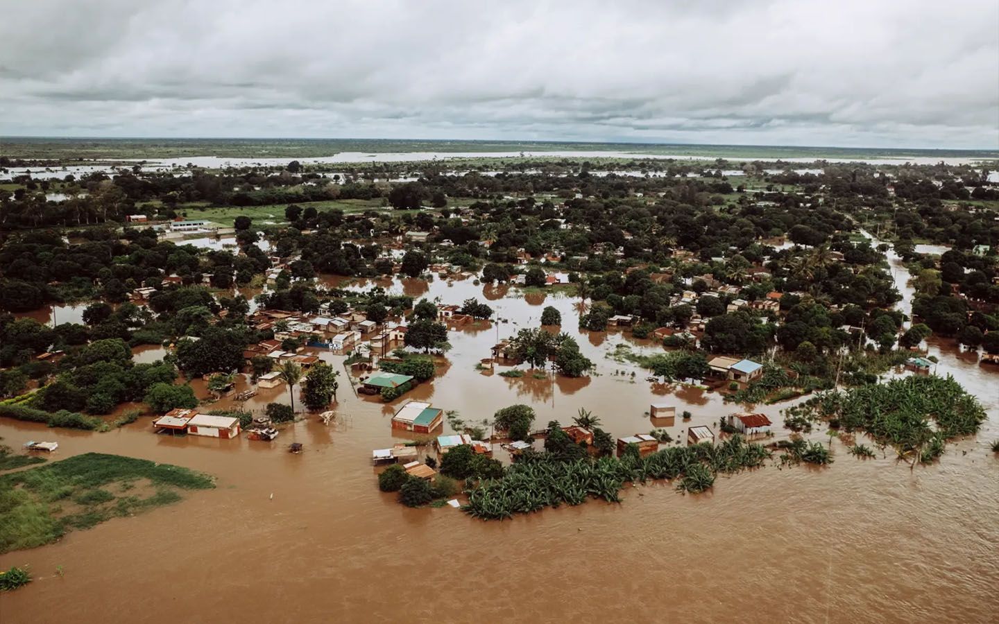
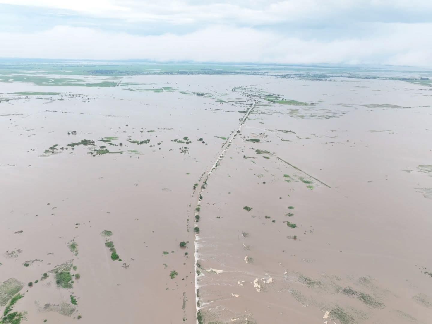
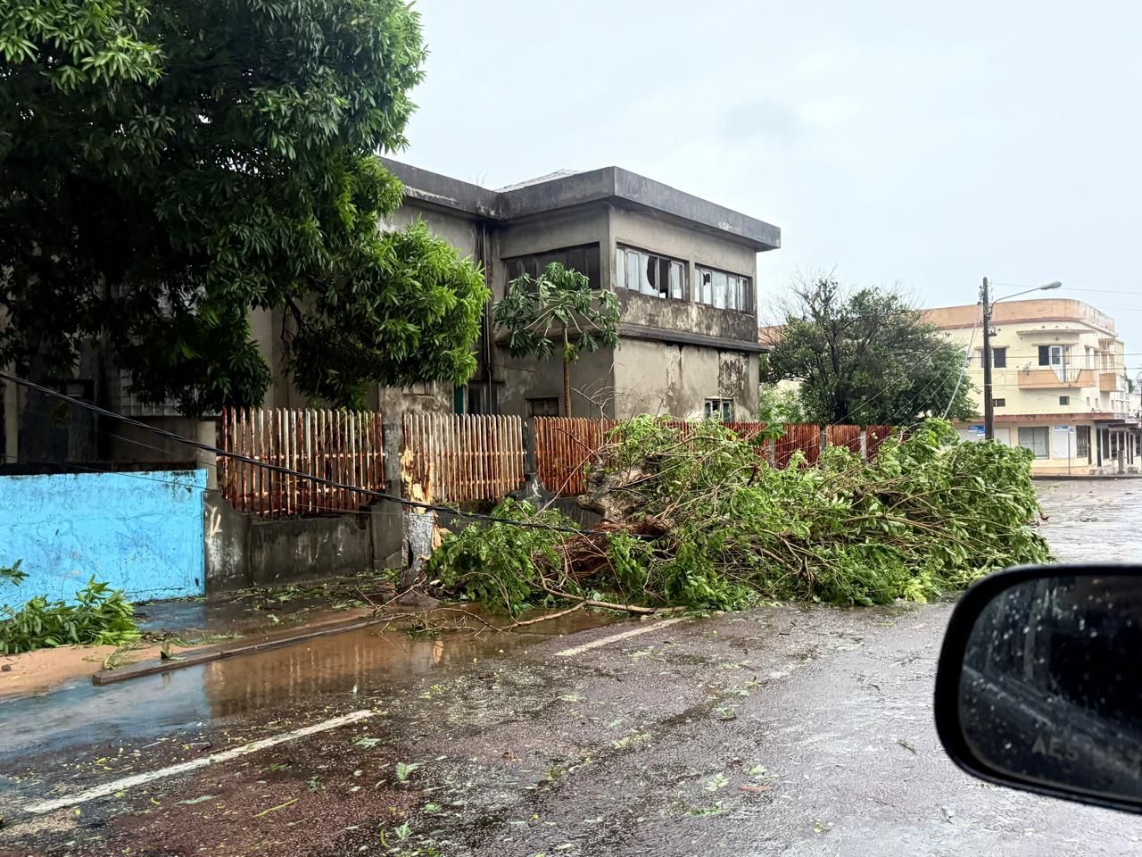
When a major storm makes landfall, Mozambique Cyclone News moves at extraordinary speed. Within hours, satellite images, drone footage and ground-level clips circulate across global platforms. Submerged streets, collapsed perimeter walls, river systems bursting their banks and entire neighborhoods framed by brown floodwater dominate international feeds. These images are real. They demand attention. But they represent peak impact zones, not national scale.
What rarely accompanies those visuals is geographic precision. Mozambique is not a compact coastal enclave. It is a vast, elongated nation stretching more than 2,500 kilometers along the Indian Ocean. Cyclones that develop in the Mozambique Channel do not blanket that coastline uniformly. They travel along defined meteorological corridors shaped by sea surface temperatures, atmospheric pressure gradients, topography and wind shear.
Impact intensity varies dramatically within short distances. One low-lying district may experience severe flooding while elevated coastal infrastructure 80 or 100 kilometers away sustains manageable wind stress and limited water retention. Severe flooding in a specific corridor does not equate to systemic devastation across the country.
Headlines often compress this complexity into a single national narrative. That compression simplifies geography, shortens recovery timelines in the public imagination and amplifies the perception of total collapse. Distortion does not require exaggeration. It emerges when scale is reduced to spectacle.
Understanding the Geography Most Coverage Ignores
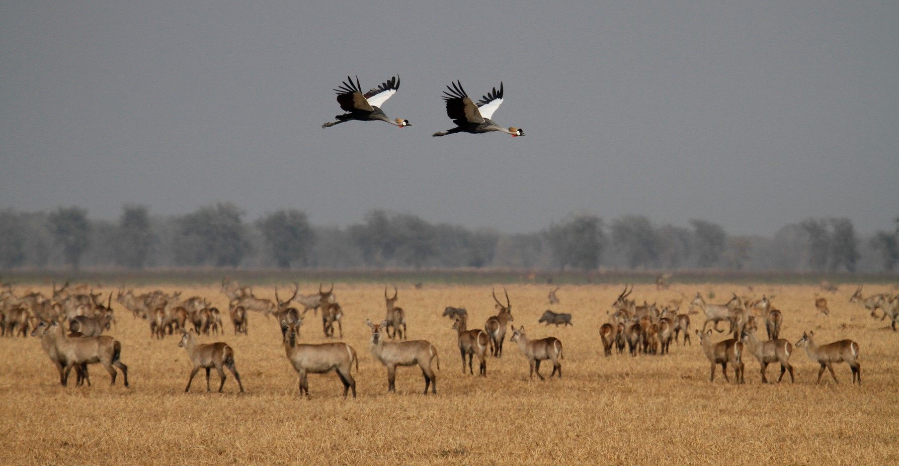
Southern Mozambique includes low-lying coastal plains and river basins where heavy rainfall accumulates rapidly. Provinces such as Gaza and parts of Inhambane contain flat terrain where drainage systems can be overwhelmed during intense downpours.
These areas are often shown in international reporting because they produce visually compelling flood scenes.
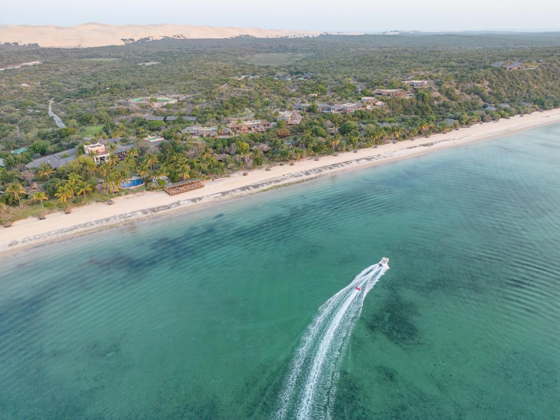
What rarely receives equal attention is topographic variation. Elevated dune systems, reinforced coastal zones and inland areas outside floodplains experience very different outcomes during the same storm. Rainfall intensity can vary dramatically within short distances.
Mozambique Cyclone News tends to highlight the most vulnerable locations without explaining that vulnerability is geographically concentrated.
How Cyclones in the Mozambique Channel Actually Behave
Cyclones in the southern hemisphere rotate clockwise. Their wind fields are uneven, and rainfall bands spiral outward irregularly. One side of the system may carry the heaviest precipitation while adjacent regions receive moderate conditions.
When a cyclone tracks inland, it loses access to warm ocean energy. Wind speeds drop rapidly after landfall. Rainfall may continue temporarily but weakens as the system fragments.
International perception often assumes prolonged catastrophic conditions. Meteorological reality shows that high-intensity coastal impact generally lasts between 24 and 48 hours before gradual dissipation inland.
That temporal compression is rarely explained in headline coverage.
Why Flood Images Dominate Global Narratives
Floodwater is visually expansive. When rain overwhelms drainage systems in flat urban basins, water spreads laterally across streets, open ground and densely built neighborhoods. From aerial perspective, that spread appears almost continuous, giving the impression of widespread inundation far beyond the actual depth or duration of flooding.
Urban floodplains and informal settlements are disproportionately represented in international coverage because damage is immediately visible. Corrugated roofing dislodges. Boundary walls collapse. Muddy water surrounds homes in ways that translate clearly through imagery. Elevated commercial buildings, reinforced lodges and engineered coastal infrastructure may experience significant wind exposure without sustaining prolonged water retention, yet those structures do not produce the same dramatic visual narrative.
The result is selective scale amplification. Mozambique Cyclone News becomes visually anchored to the most vulnerable flood basins, even when the broader geographic footprint of severe damage is comparatively narrow. What is seen most often becomes assumed to be most widespread.
Short-Term Disruption Versus Systemic Collapse
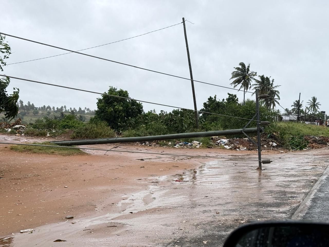
Immediately after landfall, infrastructure strain is inevitable. Roads close temporarily. Power lines may be damaged. Airports suspend operations during peak wind thresholds.
However, equating temporary disruption with structural collapse misrepresents recovery dynamics.
Primary transport corridors are cleared first. Engineering inspections begin as soon as wind speeds drop below safety thresholds. In sandy coastal zones, drainage improves rapidly once rainfall subsides.
Mozambique operates within a seasonal storm framework. Recovery protocols are not improvised. They are embedded into planning systems shaped by decades of cyclone exposure.
Recent Cyclone History in Southern Mozambique
Southern Mozambique has faced significant storms before. Cyclone Idai in 2019, Cyclone Eloise in 2021 and Cyclone Freddy in 2023 all generated international headlines. Each storm produced severe localized impact, particularly in low-lying flood basins and vulnerable communities.
What those events also demonstrated was recovery capacity. Airports reopened. Major highways were restored. Tourism zones resumed operations in phases. Reconstruction occurred where needed, but nationwide collapse did not materialize.
Cyclone cycles in the Mozambique Channel follow seasonal patterns. Some years are more intense than others. Exposure to repeated systems has shaped structural adaptation and emergency response planning across southern provinces.
Historical context matters because it demonstrates both vulnerability and resilience.
How Social Media Amplifies Perceived Devastation
During major weather events, footage circulates globally within minutes. Reposts often remove geographic detail. Older clips may resurface during new storms. Algorithmic amplification prioritizes dramatic content.
Search spikes for phrases such as “Is Mozambique destroyed?” often occur within hours of peak impact imagery. These queries reflect emotional reaction rather than geographic verification.
Mozambique Cyclone News competes in a digital environment where visual intensity drives engagement. Nuanced geographic explanation rarely travels at the same speed as dramatic flood footage.
Distortion emerges from amplification, not necessarily exaggeration.
How International Headlines Influence Travel Perception
Storm headlines influence travel psychology. When global media repeatedly show flood imagery without geographic clarification, potential visitors may assume widespread, long-term disruption.
In reality, tourism regions operate within recovery frameworks designed for seasonal weather volatility. Travel hesitation often persists longer online than physical disruption persists on the ground.
Understanding how headlines shape perception is essential. Travel decisions should be based on verified regional impact rather than generalized national imagery.
Mozambique Cyclone News informs global awareness. It should not automatically redefine national viability in the absence of geographic precision.
Resilience Is Structural, Not Abstract
Southern Mozambique’s coastal infrastructure reflects decades of direct exposure to tropical systems moving through the Mozambique Channel. Cyclones are not rare anomalies in this region. They are recurring seasonal risks that have shaped both public and private sector construction practices over time.
In formal construction zones, reinforced roofing systems are now standard rather than exceptional.
Anchored truss systems, concrete ring beams, and strengthened wall-to-roof connections reduce uplift damage during high-wind events. Elevated foundations in flood-prone districts are designed to mitigate short-duration water accumulation. Drainage engineering, including graded run-off channels and stormwater redirection systems, plays a critical role in limiting prolonged standing water in built-up areas.
Municipal planning in key coastal towns increasingly incorporates floodplain mapping and seasonal risk assessment into zoning decisions. While vulnerabilities remain, particularly in informal settlements, formal infrastructure corridors are not constructed without reference to storm exposure patterns.
Tourism infrastructure in particular operates within a defined resilience framework. Established lodges and coastal resorts implement pre-storm protocols that include securing external structures, activating backup generators, protecting water supply systems, and staging post-storm inspection teams. Many properties maintain contingency logistics networks for rapid repair and debris clearance.
Structural resilience does not eliminate storm damage. Windows can break. Vegetation can suffer wind stress. Minor flooding can occur in vulnerable zones. But resilience reduces prolonged operational shutdown and systemic collapse. It transforms a potential months-long disruption into a defined recovery window measured in days or weeks.
Media coverage understandably concentrates on visible damage: collapsed roofing, submerged streets, compromised housing. What receives less attention are the embedded engineering adaptations that prevent localized damage from cascading into nationwide infrastructure failure.
Resilience in southern Mozambique is not rhetorical. It is engineered, procedural and repeatedly tested.
Recovery Cycles Move Faster Than Global Attention
International media attention peaks during landfall and immediate aftermath. Within days, global focus shifts elsewhere. On the ground, recovery continues methodically.
Debris clearance accelerates once rainfall subsides. Power restoration proceeds in phases. Airport inspections allow gradual resumption of operations. Supply chains stabilize in prioritized corridors.
Physical recovery often unfolds faster than global perception adjusts.
Reading Mozambique Cyclone News With Precision
Two questions clarify scale:
Where did the highest wind speeds and rainfall totals occur?
What was the geographic radius of severe flooding?
Without geographic specificity, readers may assume uniform impact across a vast coastline.
Cyclones are serious events. They require response and support. But they are rarely synonymous with nationwide devastation.
Mozambique Cyclone News should be interpreted through meteorology, geography and recovery dynamics rather than through visual intensity alone.
Seasonal storms are part of regional climate reality. So is adaptation.
Featured Packages
Frequently Asked Questions
Is Mozambique usually devastated nationwide after a cyclone?
Cyclones typically affect defined coastal corridors rather than the entire country. Severe flooding may occur in specific low-lying districts, but other provinces remain operational. Headlines can compress geographic scale, creating the impression of widespread collapse when impact is regionally concentrated.
Why do flood images from Mozambique look so extreme?
Flood imagery often comes from river basins and flat urban zones where water accumulation is visually dramatic. These areas are more accessible for filming. Elevated coastal infrastructure and reinforced buildings may experience far less visible structural damage than shown in widely circulated footage.
How long do cyclone conditions usually last?
High-intensity coastal impact generally lasts 24 to 48 hours after landfall. Wind speeds decrease as systems move inland and lose ocean energy. Rainfall may persist temporarily but weakens rapidly. Prolonged hurricane-force conditions nationwide are uncommon beyond the immediate impact corridor.
Are cyclones becoming more frequent in Mozambique?
Cyclone frequency varies seasonally and is influenced by ocean temperatures and atmospheric conditions in the Mozambique Channel. Some seasons are more active than others. Climate variability may influence intensity patterns, but storms remain geographically concentrated rather than uniformly nationwide events.
Why is southern Mozambique mentioned most in storm coverage?
Southern provinces lie along common Mozambique Channel storm trajectories and contain visible floodplains. Geographic positioning and topography concentrate impact in specific districts rather than evenly across the coastline, which explains their prominence in international reporting.
Does repeated cyclone exposure damage tourism long term?
While severe storms can cause localized damage, established tourism infrastructure incorporates reinforced construction and recovery protocols. Repeated seasonal exposure has shaped adaptation strategies that support phased reopening rather than long-term regional shutdown. Impact is location-specific rather than national.
Is Mozambique safe for travel after cyclone season?
Travel suitability depends on regional impact and recovery progress, not on headline intensity alone. Many coastal areas stabilize quickly after storms dissipate. Verifying geographic impact and infrastructure status provides clearer decision-making than generalized national imagery.
How should readers interpret dramatic storm headlines responsibly?
Readers should examine geographic specificity and differentiate district-level flooding from national conditions. Asking where the strongest rainfall occurred and how wide the impact corridor extended provides clearer understanding than relying solely on emotionally powerful imagery.
SHARE THIS POST
Are You Ready FOr Mozambique?
Page through our packages and find the offer right for you!
Ready to Speak to a Mozambique Travel Expert?
Get In Touch and Ask for a Call-Back Today
Latest Posts


Mainland Coastal Sanctuaries in Vilanculos: Why Mozawi Signals a New Direction for Mozambique Travel