

Mozambique Sky Islands Expedition Part One: Searching for Lost Mountains
By Kevin Record, Founder and Managing Director of Mozambique Travel • October 14, 2026
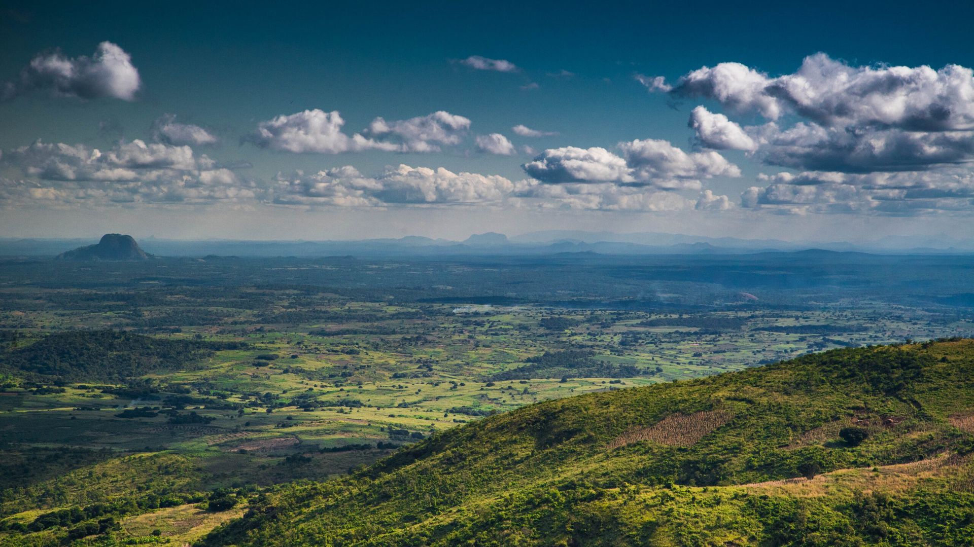
After more than 30 years of traveling through Mozambique, I am still regularly reminded of how little I know about parts of the country.
That is not false modesty. Mozambique is enormous, geographically complicated and frequently difficult to explore. Beyond its better-known coastline, islands and safari destinations are mountain ranges, isolated forests and rural landscapes that remain almost entirely absent from conventional travel itineraries.
Some of the most remarkable of these are Mozambique’s Sky Islands.
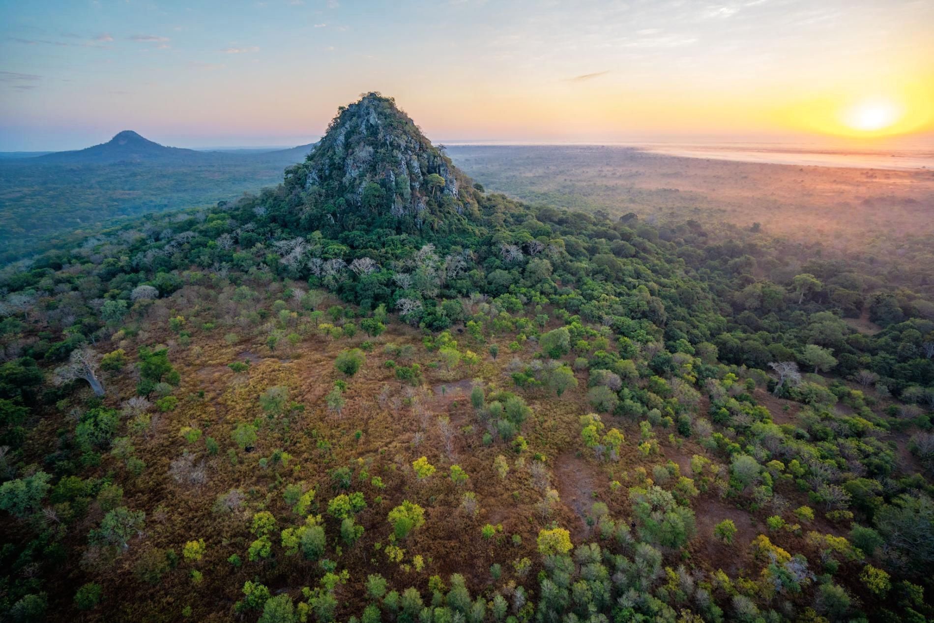
These isolated mountains rise above the surrounding lowlands and contain pockets of forest, grassland and wildlife separated from similar habitats elsewhere. Certain plants and animals survive on a single mountain or within one restricted group of peaks.
From a conservation perspective, these forests can be exceptionally important. For a traveler, they are beautiful, intriguing and often extremely difficult to reach.
In July 2026, I set out to see several of them for myself.
This was the first stage of a much larger journey through northern Mozambique. Our planned route included Mount Gorongosa, Mount Mabu, Mount Lico and Mount Namuli before continuing north toward Lake Niassa, Niassa Special Reserve and eventually the coast.
It was not a commercial tour or a carefully choreographed media trip. It was a private reconnaissance expedition intended to improve my understanding of the country and investigate possibilities for future journeys.
Some objectives were achieved. Others were only partially completed. A few had to be abandoned.
That uncertainty became part of the experience.
Why I Wanted to Explore Mozambique’s Sky Islands
I have worked in Mozambique travel for 25 years, but my personal relationship with the country stretches back more than three decades.
During that time, I have crossed Mozambique by road, visited its islands, explored its parks and worked with lodges, guides, conservationists and tourism operators throughout the country.
I have watched destinations develop, disappear and re-emerge. I have also learned that maps rarely tell the entire story.
The Sky Islands had interested me for years.
Mountains such as Mabu, Lico and Namuli form part of the South East Africa Montane Archipelago, or SEAMA. This recently defined ecoregion includes a series of isolated mountains across northern Mozambique and southern Malawi.
The peer-reviewed SEAMA biogeographical study published in Scientific Reports identifies 30 major granitic inselbergs and records 127 endemic plants, 45 endemic vertebrates and 45 endemic invertebrates across the ecoregion.
It also identifies Mount Mabu as supporting southern Africa’s largest mid-elevation rainforest and Mount Lico as supporting its smallest.
Those figures explain the scientific importance of the region, but they do not convey what these mountains feel like on the ground.
On a map, each mountain appears to be a destination. In reality, every one forms part of a complicated human and environmental landscape.
There are farming communities, forestry concessions, forgotten roads, seasonal rivers, charcoal production, conservation projects, and local authorities with their own responsibilities and priorities.
I wanted to understand more than where the mountains were. I wanted to see the surrounding landscapes, meet some of the people living near them, and determine what meaningful travel into these regions might involve.
For a broader introduction to their geography, ecology, and conservation importance, see our Mozambique’s Sky Islands guide.
Four Travelers, One Old Land Cruiser and an Optimistic Plan
The expedition team was small.
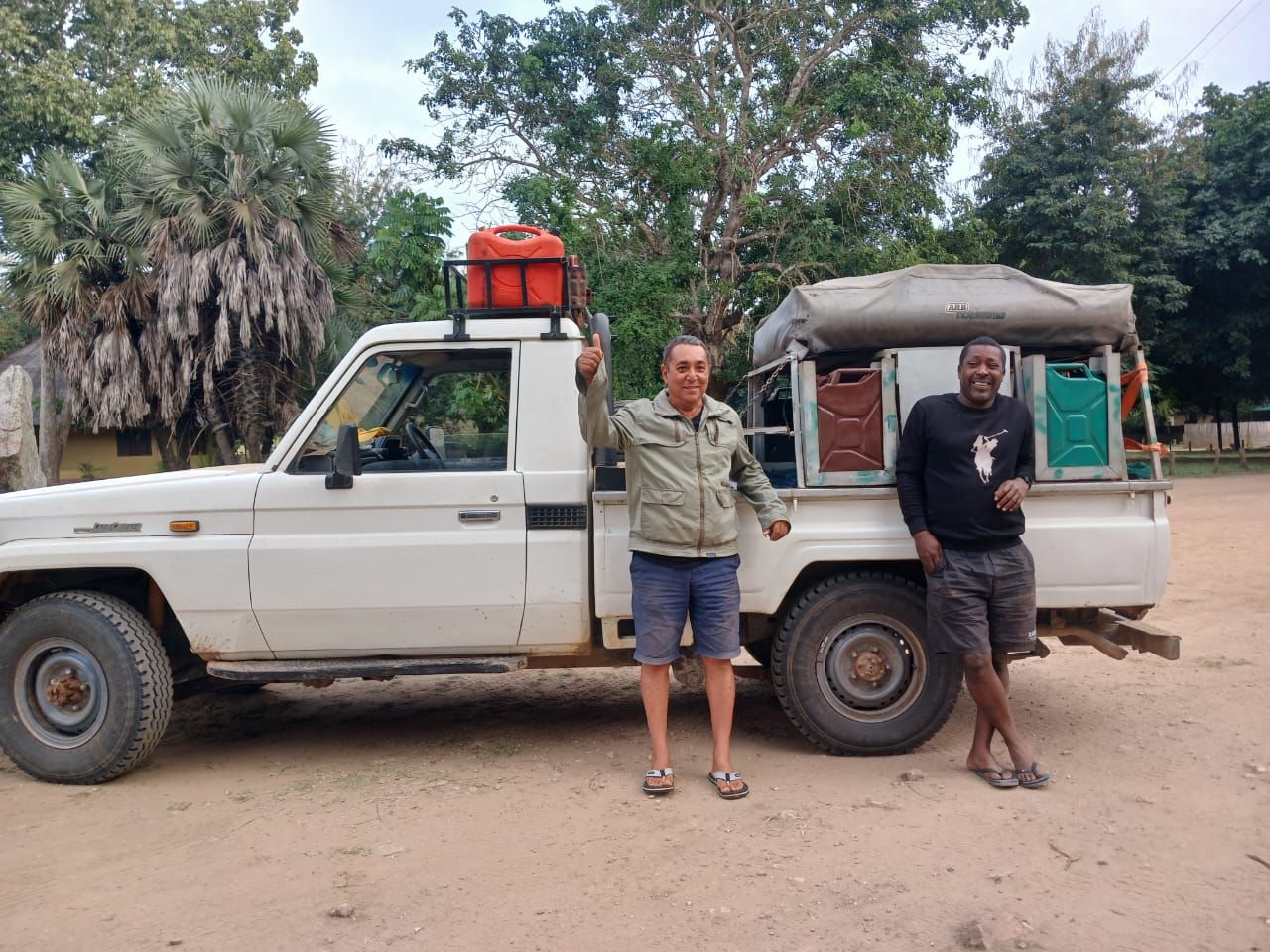
My 15-year-old son, Sam, traveled with me. We were joined by my long-time friend Marco Gonzalez, whom we call Meca, and our mechanic and friend, Chico, otherwise known as Candonguero.
Our vehicle was a Toyota Land Cruiser 79 Series that had already completed approximately 450,000 kilometers.
It was familiar, capable, and extremely well used. For a journey like this, I would take a proven vehicle with a few scars over an immaculate showroom vehicle every time.
The Land Cruiser carried recovery equipment, tools, fuel, water, camping gear, food and enough mechanical spares to deal with the most likely problems.
Even so, preparation only takes you so far.
We had planned routes, satellite imagery and approximate coordinates. We also knew that tracks could be washed away, overgrown, blocked, or completely different from what appeared on a screen.
The plan was detailed but deliberately flexible.
In remote Mozambique, the road eventually decides.
Beginning in Gorongosa National Park
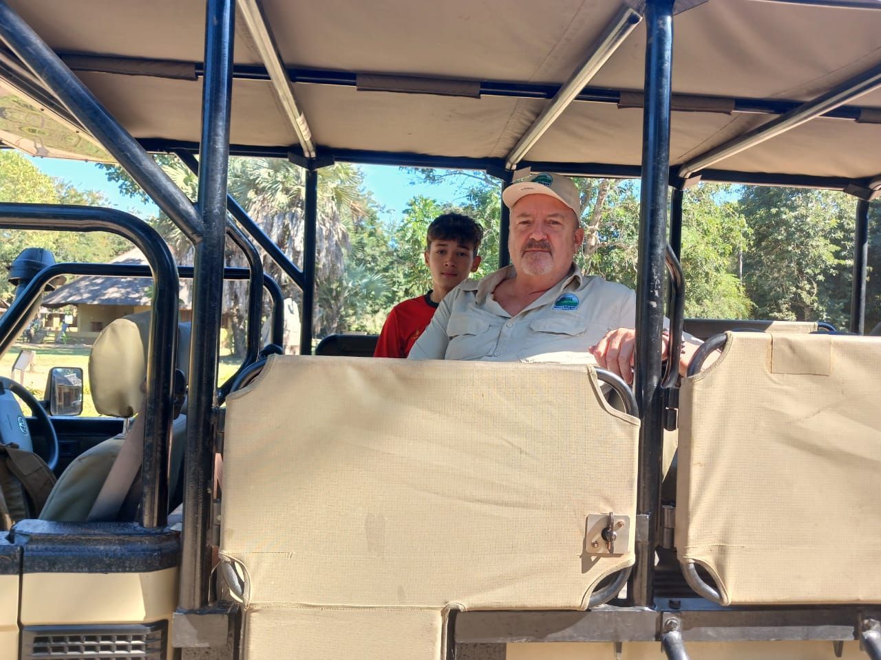
Sam and I began the journey in Gorongosa National Park, flying in with Air Gorongosa before meeting Meca and Chico.
Our visit had two purposes.
The first was professional. I wanted to inspect Muzimu Lodge and Chicari Camp and assess the current safari experience. Mozambique Travel has been sending clients to Gorongosa since 2003, and maintaining that first-hand knowledge is fundamental to how we work.
The second purpose was personal. Mount Gorongosa was the first Sky Island on our route.
Before heading into the mountains, Sam and I explored the park with an excellent guide, also named Sam. We saw lions, ground hornbills, fish eagles, snake eagles and carmine bee-eaters, and visited the Pangolin Centre to learn more about its conservation work.
Gorongosa is one of Africa’s most important ecological recovery stories. Wildlife populations devastated during Mozambique’s civil war have been rebuilt through long-term protection, scientific research, community development and patient management.
What impressed me most was not simply the increase in wildlife. It was the depth of the project.
Gorongosa’s restoration is connected to education, healthcare, employment, agriculture, and communities surrounding the park. Not every challenge has been resolved, but there is a serious attempt to address conservation as part of a much larger social landscape.
We camped near Chitengo, where Meca and Chico joined us with the Land Cruiser, the expedition equipment and a live chicken.
The chicken was intended to become dinner.
It did, although considerably more chewing was required than any of us had anticipated.
It was a suitably unglamorous beginning to an expedition that was never going to resemble a polished travel documentary.
Mount Gorongosa and the Coffee Project
From the park, we traveled toward Mount Gorongosa.
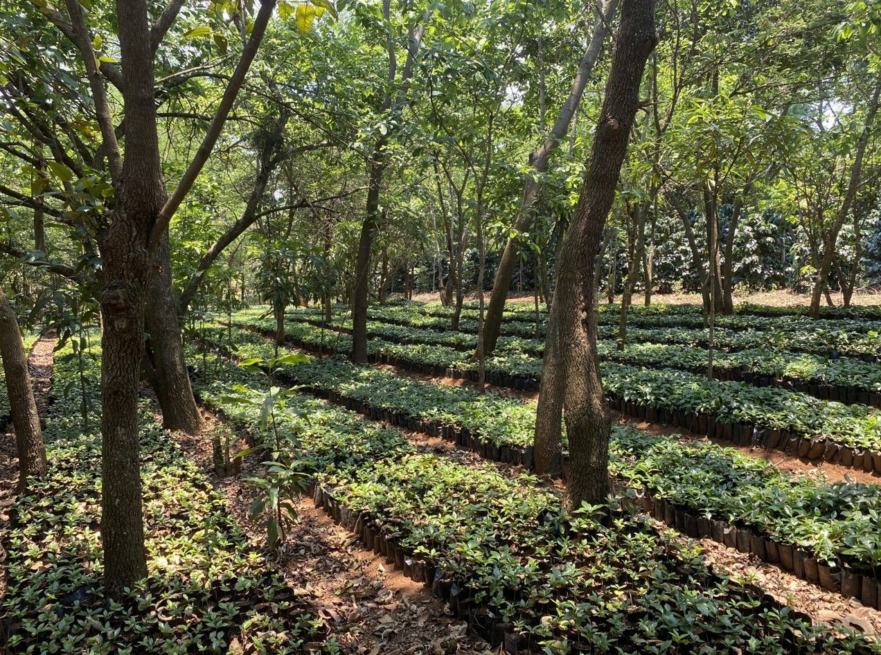
The lower slopes are inhabited and cultivated, and our route climbed through settlements and agricultural land before reaching an area used by the Gorongosa Coffee Project.
The project encourages farmers to grow coffee beneath indigenous trees. This creates an income linked to restoring forest rather than clearing it. Coffee cultivation is combined with tree planting, farmer training, and efforts to protect water sources and biodiversity.
We stayed near a coffee-cherry collection point roughly halfway up the mountain.
One small incident revealed a great deal about the project’s philosophy.
Some farmers arrived with green coffee cherries mixed among the ripe red fruit. The buyers accepted them.
In a strictly commercial system, poor-quality produce might simply be rejected. Here, the understanding was that many farmers were still learning. Refusing the crop could remove desperately needed income without addressing the underlying problem.
The approach was to purchase, explain, and train.
It was not a perfect system, but it showed a willingness to build knowledge rather than punish farmers for not already having it.
The following morning, we walked higher with Raul, one of the local guides. The vegetation changed as we climbed, and we entered fragments of the Afromontane forest that once covered a much larger area.
Mount Gorongosa is more than a scenic extension to the national park. Its forests, grasslands and wetlands form a distinctive highland ecosystem and help feed the water systems on which the lower landscape depends.
The detailed Vegetation Survey of Mount Gorongosa, published by the Biodiversity Foundation for Africa, documents the mountain’s forest, woodland, grassland and wetland habitats and explains their ecological and hydrological importance.
For birders, the mountain is particularly rewarding.
We saw Livingstone’s turaco, green-headed oriole and yellow-billed waxbills, along with other forest and mountain species.
The green-headed oriole was especially important. The Mount Gorongosa subspecies is associated with a very restricted area of remaining highland forest.
We also walked to Gorongosa Falls.
Above the falls, I scattered some of my recently departed mother’s ashes into the river.
It was an intensely personal moment, shared with my son in a landscape that has meant a great deal to me over many years. The river carried the ashes toward the edge and into the gorge below.
Of everything that happened during the expedition, that quiet moment will remain one of the most important.
A Mountain Facing Difficult Pressures
Mount Gorongosa is beautiful, but its environmental pressures are impossible to ignore.
Parts of the slopes have been cleared and burned for agriculture. Bare ground is vulnerable to erosion, while fragmentation threatens species that depend on the remaining high-altitude forest.
It is easy for an outsider to look at a cleared mountainside and condemn what has happened. The reality is more complicated.
The people farming these slopes are not abstract environmental threats. They are families trying to produce food and earn an income.
Conservation will only work if it offers practical alternatives that local communities can trust.
That is why projects involving coffee, education, employment, and long-term agricultural support matter. Protecting the mountain cannot simply mean excluding the people who live on it. The challenge is to make a living forest more valuable than a cleared one.
We left Mount Gorongosa with a greater appreciation for both the recovery taking place and the scale of the work still required.
Our next major objective was Mount Mabu.
First, however, we wanted to visit a very different piece of Mozambique’s history.
A Difficult Road Toward the Zambezi
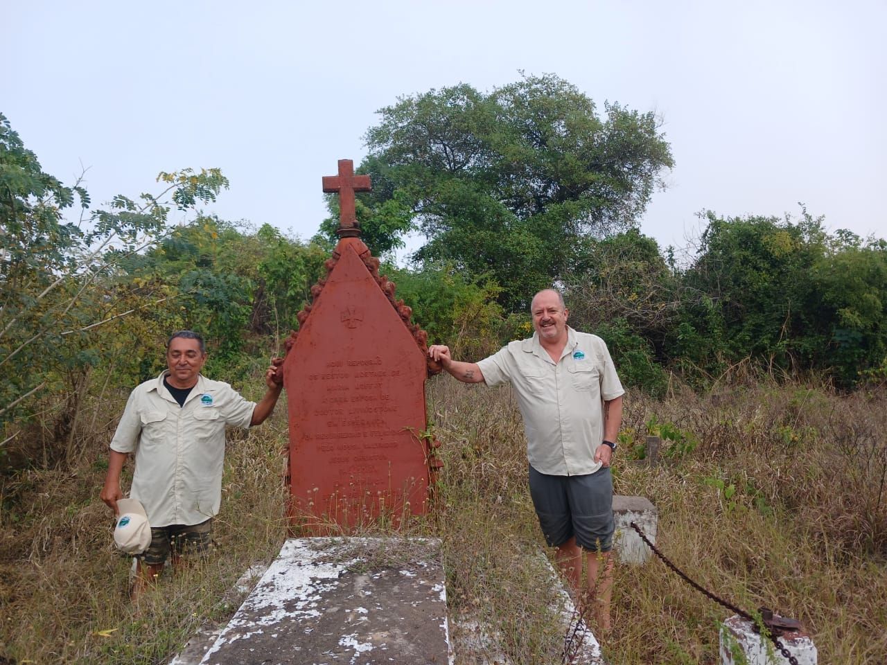
Our route took us toward Chapanga, near the Zambezi River, where Mary Moffat Livingstone is buried.
The roads deteriorated as we traveled. Progress became slower, and the Land Cruiser was subjected to the corrugations, potholes, dust, and disappearing tracks familiar to anyone who has driven extensively through rural Mozambique.
Meca handled much of the driving with his usual patience.
There is no value in manufacturing drama on a difficult road. Speed creates damage, mechanical failures, and unnecessary risk. The objective is not to demonstrate how aggressively a vehicle can be driven. It is to arrive with the vehicle, equipment, and passengers intact.
We stopped overnight at a hunting camp and continued toward Chapanga the following morning.
It was Sunday.
That proved significant.
Mary Moffat Livingstone and a Sunday at Chapanga
Mary Moffat Livingstone, the wife of explorer and missionary David Livingstone, died of malaria near the Zambezi in 1862. She was 41 years old.
Her grave is an important historical site, but our visit became memorable for something far more immediate.
A church service was underway when we arrived.
Music, voices and drums carried through the settlement. Instead of encountering a silent monument, we found ourselves within a living community.
We had reached Chapanga with satellite navigation, a capable four-wheel-drive vehicle, modern medicine, communications equipment and detailed maps. Mary Livingstone made her journeys in an era when disease, distance and isolation carried consequences that are difficult for modern travelers to comprehend.
Standing near her grave also raised questions about how the history of exploration is presented.
Written accounts tend to concentrate on a small number of European explorers. The African guides, porters, interpreters, and communities that made those journeys possible frequently disappear from the narrative.
The landscape around Chapanga has never been empty. It contains histories extending far beyond the names recorded in European books.
The church service made that especially clear. Life had not stopped around the grave. The community had its own identity, faith, memory, and momentum.
We left quietly and continued toward Mount Mabu.
Mount Mabu and the Forest We Did Not Reach
Mount Mabu became internationally famous after satellite imagery drew scientific attention to an extensive area of forest on the mountain.
It was widely described as a “lost forest” or the “Google Forest.”
Those descriptions need qualification. The mountain was never lost to the people living around it. Local communities knew the forest, used its lower slopes and understood its presence long before it attracted international scientific interest.
What changed was its recognition by the scientific world.
Research expeditions began documenting a remarkably intact block of mid-altitude rainforest and an exceptional range of plants and animals.
The principal peer-reviewed paper, The Discovery, Biodiversity and Conservation of Mabu Forest, records approximately 7,880 hectares of largely undisturbed rainforest.
At the time of publication, researchers had confirmed ten species new to science from Mount Mabu, including plants, mammals, reptiles and butterflies. The authors also noted that several groups had received relatively limited scientific sampling, leaving substantial potential for further discoveries.
Scientists have described new species connected to the mountain, including the Mount Mabu forest viper and a pygmy chameleon.
This combination of forest extent, isolation and biological discovery has made Mabu one of Mozambique’s most important mountain conservation sites.
We approached the mountain through cultivated landscapes, streams and increasingly difficult tracks.
The lower slopes were green and impressive, but we did not reach the high forest.
That was frustrating, although also instructive.
A point on a map can create the illusion that a destination has been reached. With a mountain such as Mabu, entering the surrounding area is not the same as understanding the forest.
A serious visit would require a suitable base camp, local guides, permissions, and several days on foot. Trying to force the objective into the available time would have produced little more than a photograph and a claim that we had been there.
That was not what I wanted.
Mount Mabu deserves a dedicated return journey.
Searching for Mount Lico
Mount Lico presented a different challenge.
The mountain attracted international attention following a multidisciplinary scientific expedition to its summit forest in 2018.
Its near-vertical rock walls make access technically demanding. Climbers first had to establish ropes before scientists and their equipment could reach the summit.
We had no intention of attempting that climb.
Our objective was to reach the surrounding landscape, see the mountain from below and understand the practicalities of approaching it by road.
We had coordinates, but there was no clear route.
Digital maps are useful until they are not. A line visible on satellite imagery may be a plantation road, a footpath, an abandoned track or something that no longer exists. An important local road may not appear on the map at all.
We stopped frequently to ask directions and explain who we were. International leisure travelers rarely drive through these areas, so our presence naturally attracted interest.
Some conversations directed us forward. Others led to backtracking, another village and a different interpretation of where the road went.
Eventually, the landscape opened.
Then we saw Lico.
The First Sight of Mount Lico
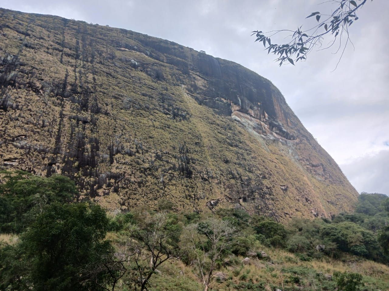
Mount Lico is far more dramatic in person than it appears in photographs.
It rises abruptly from the surrounding countryside, with a summit forest separated from the lower landscape by immense, near-vertical rock walls. From below, the forest seems almost impossibly inaccessible.
It does not resemble an ordinary wooded mountain. It looks like a fragment of another world lifted above the countryside and protected by stone.
The 2018 scientific expedition did more than conduct a biological survey. Researchers collected evidence that challenged the idea of the summit forest as a place entirely insulated from past disturbance.
The later peer-reviewed study, Tree Demographics and Soil Charcoal Evidence of Fire Disturbances on Mount Lico, examined tree populations and soil charcoal collected from the summit.
The research produced an environmental record extending back approximately 8,000 years and showed that fire had affected the forest during its history. This made the ecological story more complex than the simple description of an untouched forest.
Scientific work associated with the expedition also documented reptiles, butterflies, freshwater crabs, plants and other organisms from Lico and nearby mountains, including species new to science.
The cliffs have protected the summit from much of the recent agricultural and commercial pressure affecting more accessible forests. Around the base, however, the present-day contrast is striking.
Above is an isolated forest protected by geography. Below are cultivated fields, settlements, forestry operations, charcoal production and commercial activity.
We did not climb Lico.
Reaching the summit forest requires technical climbing ability, specialist equipment, legitimate research objectives, and proper local coordination. It is not a conventional hiking destination and should never be promoted as one.
We stood beneath the mountain and looked.
Sometimes that is enough.
For me, Lico was the most visually powerful Sky Island we encountered. I immediately wanted to return, but not to plant a flag or claim the mountain.
I wanted more time in the landscape around it. I wanted to speak to communities, follow the surrounding tracks, and better understand what was changing below the protected forest.
The mountain was extraordinary. The more urgent story was everything happening around it.
Gurué and the Mountains Beyond the Tea Estates
From Lico, we continued toward Gurué.
The landscape changed as we entered one of Mozambique’s historic tea-growing regions. Old plantations lie beneath dramatic granite mountains, creating scenery unlike anything we had encountered earlier in the expedition.
Gurué gave us time to rest, reorganize, and prepare for Mount Namuli.
Namuli had always been one of the expedition’s principal objectives. At approximately 2,419 meters, it is among Mozambique’s highest mountains, but its importance extends beyond altitude.
The Namuli massif contains isolated forest, montane grassland, granite peaks and species with extremely restricted distributions. It is not one mountain that can be understood from a single viewpoint. It forms part of a much larger highland environment.
We followed increasingly difficult roads toward it. Once again, progress was much slower than the map suggested.
We got reasonably close before confronting the problem that had followed us throughout the journey.
Time.
We could have forced the Land Cruiser farther along the deteriorating tracks. With another hour or two, we might have reached a predetermined point and declared that we had “done” Namuli.
Mabu had already taught us the difference between arriving and exploring.
Namuli deserved time on foot, local guidance and enough flexibility to follow a route without constantly calculating the remaining daylight.
The Sky Islands were also only the first stage of a longer expedition. Lake Niassa lay far to the north, followed by Niassa Special Reserve.
Something had to give.
This time, it was Namuli.
We turned back disappointed, but certain that the decision was correct.
A Mountain Landscape Under Pressure
As we left the Gurué and Namuli region, I looked east.
Mountain followed mountain, divided by valleys, ridges and passes. Narrow tracks disappeared toward ranges that a conventional vehicle would struggle to reach.
We had spent days concentrating on the recognized names: Gorongosa, Mabu, Lico and Namuli.
Suddenly, I was looking across an immense mountain landscape about which I knew almost nothing.
Some peaks were marked on maps. Others were simply shapes on the horizon. Each might contain forest fragments, water sources, species and communities with their own stories.
The scale of the landscape was exhilarating. It was also worrying.
Isolated mountain ecosystems are particularly vulnerable. A small area of cleared forest can represent a substantial proportion of the habitat available to a highly restricted species.
Agriculture, charcoal production and timber provide essential income, but they can also place extreme pressure on forests.
The answer cannot be conservation imposed without local benefit. Nor can every mountain simply be opened to tourism.
Responsible access must begin with permission, local knowledge and a clear understanding of whether visitors will contribute anything useful.
In some places, carefully managed tourism could support guides, accommodation, transport and conservation. In others, scientific research or community-led environmental projects may be more appropriate.
The first responsibility is to listen.
Why I Want to Return on Two Wheels
The Land Cruiser was essential to the expedition. It carried our equipment, water, fuel, and camping supplies over thousands of kilometers.
It also had limitations.
Many routes around the mountains narrowed into tracks better suited to motorcycles, bicycles, or travel on foot. Turning a heavily loaded four-wheel-drive vehicle around was sometimes difficult, and exploring every possible track would have consumed days.
I began imagining a future expedition by motorcycle.
A motorcycle would allow us to follow narrower tracks, explore passes, and reach settlements that cannot be approached easily in a larger vehicle. It would not make the journey simple, but it would change what was possible.
Namuli and the mountains east of Gurué would be the priority.
The purpose would not be to race between peaks. It would be to travel slowly, work with people who know the region, and record what is happening in landscapes receiving very little international attention.
There is urgency in that idea.
Some of these forests are changing rapidly. Returning in five or ten years may mean seeing something very different.
We Did Not Conquer Anything
Expedition language often relies on words such as “conquered,” “completed,” and “untouched.”
None feels appropriate here.
We reached Mount Gorongosa and walked into its remaining forest. We approached Mount Mabu but did not reach the high rainforest. We found Mount Lico and stood beneath its cliffs. We traveled toward Namuli but turned back before reaching our intended point. We never reached Ribáuè, which had also appeared in early versions of the route.
Measured as a checklist, the results were mixed.
Measured in understanding, the expedition was enormously valuable.
The mountains exposed the limitations of our maps, schedule, and assumptions. They gave us more questions than answers and converted future destinations into future responsibilities.
The most honest result of exploration is not always a collection of achievements.
Sometimes it is a better understanding of how much remains unknown.
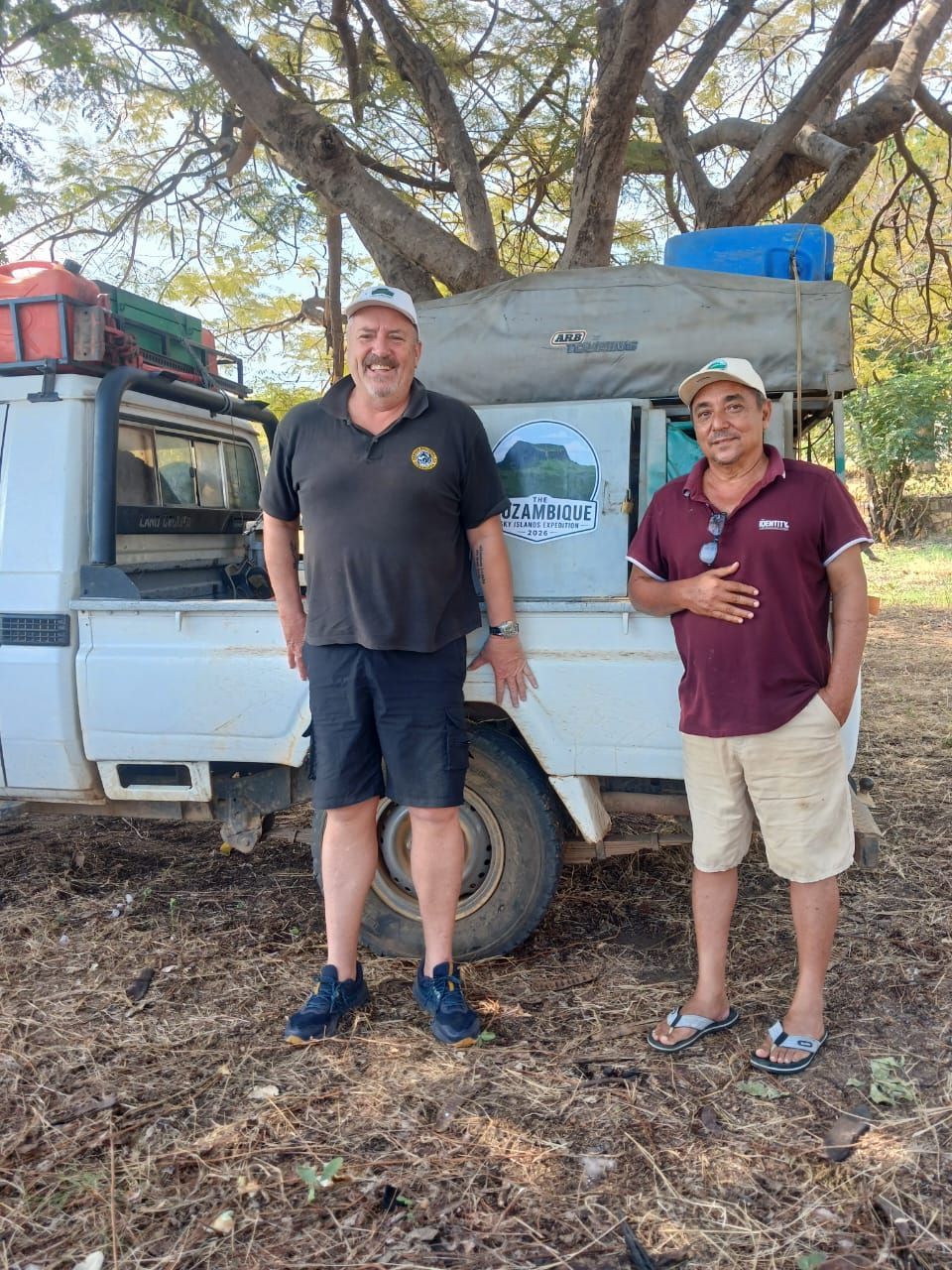
Sharing the Expedition With My Son
I was incredibly fortunate to share this stage of the journey with Sam.
At 15, he experienced an extraordinary cross-section of Mozambique in a relatively short time. He saw Gorongosa’s lions and birdlife, walked through mountain forest, visited the coffee project, stood beneath Mount Lico, and traveled through remote communities far beyond the country’s established tourism routes.
He also experienced the less glamorous realities of an overland expedition.
There was dust, heat, long driving days, uncomfortable roads, uncertain meals, and a chicken that required unreasonable determination to eat.
Traveling together created time that is increasingly difficult to find in everyday life. We talked, disagreed, laughed, and watched the landscape change through the windscreen.
I do not know which parts of the journey he will remember most clearly in 20 years.
For me, the fact that we did it together is inseparable from the expedition itself.
Why Mozambique Travel Continues to Explore
Most Mozambique Travel clients will never follow this route.
They will not need to search for disappearing tracks, sleep near coffee collection points, or spend hours asking for directions to a mountain that appears obvious on satellite imagery.
That is not the point.
We explore because first-hand knowledge changes the quality of advice we can give.
After 25 years of creating holidays in Mozambique, we know that the best journeys are not designed by repeating hotel descriptions or copying what appears online. They are created by understanding distances, access, seasons, personalities, limitations, and what a place genuinely feels like.
Exploration also keeps our view of Mozambique alive.
It prevents us from reducing the country to the same familiar collection of beaches, islands, and safari lodges. Those destinations are exceptional, but they represent only part of Mozambique.
The mountains revealed another country: biologically rich, culturally complex, environmentally threatened, and still largely unknown to international travelers.
We set out looking for four Sky Islands.
We returned wanting to understand 20 more.
The Mountains Behind Us and Lake Niassa Ahead
Leaving the Namuli highlands did not mean the expedition was over.
We turned north toward Lichinga and Lake Niassa, where a completely different Mozambican landscape awaited us.
From there, the plan was to continue through Niassa Special Reserve, follow the Lugenda region and eventually work our way toward the northern coast.
The mountains had already slowed us down, changed our expectations, and forced us to make difficult choices.
We had no reason to believe the next stage would be any more predictable.
That was precisely why we were there.
Continue the journey in Sky Islands Expedition Part Two: Lake Niassa and Niassa Special Reserve.
Explore Mozambique With First-Hand Specialists
This expedition was not a packaged holiday, and we would not recommend attempting the same route without serious planning, local coordination, and appropriate expedition experience.
It did, however, strengthen our ability to create highly personal journeys through Mozambique.
Mozambique Travel has specialized in the country for 25 years. We continue to inspect lodges, travel the roads, meet guides and explore regions receiving little conventional tourism.
Mozambique Travel does not currently sell Mount Mabu, Mount Lico, Mount Namuli, Lake Niassa or Niassa Special Reserve as standard holiday destinations.
Our commercial travel planning focuses on the regions where dependable accommodation, appropriate support and tested logistics allow us to look after our clients properly.
Whether you want to combine Gorongosa with the coast or create a more unusual journey through established parts of Mozambique, our advice is based on current, first-hand experience.
Talk to Mozambique Travel about creating a journey that goes beyond the obvious.
Featured Packages
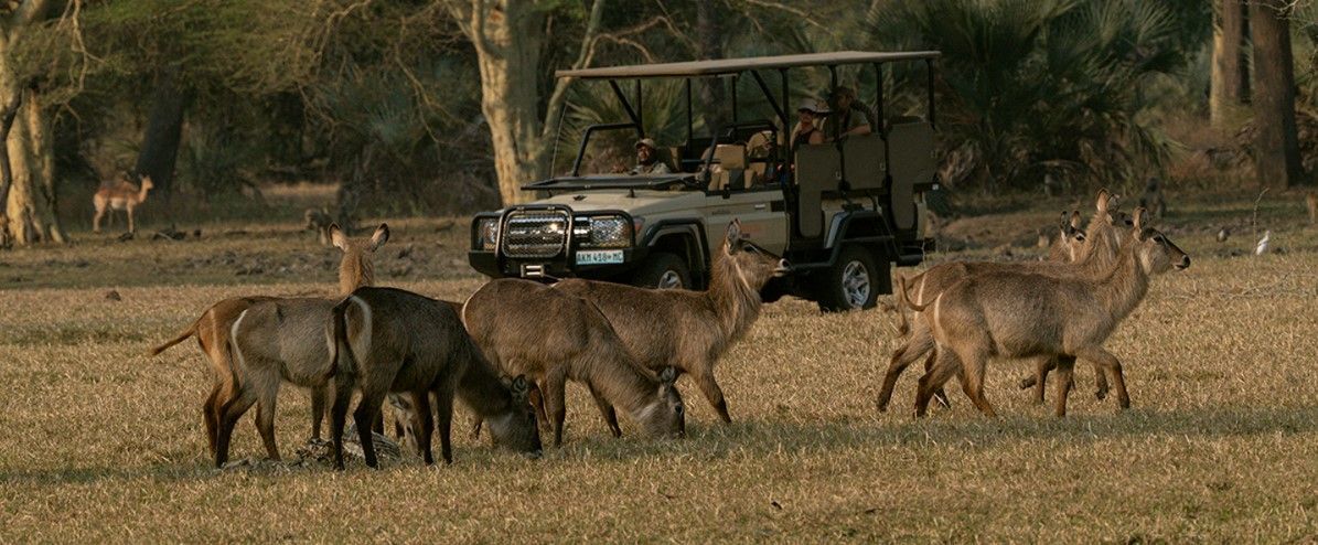
Mozambique Culture Safari and Beach Package 2026
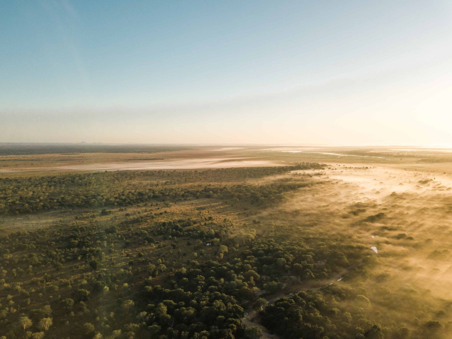
Five-Night Gorongosa Safari Explorer
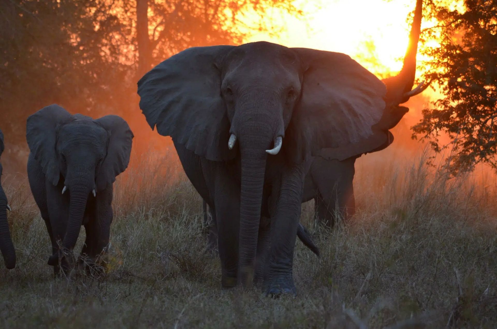
Chicari Camp Five-Night Safari From Johannesburg
Frequently Asked Questions
What is a Sky Island?
A Sky Island is an isolated mountain or highland ecosystem separated from similar habitats by warmer, lower-lying terrain. This isolation can allow distinctive plants and animals to evolve, including species found within extremely limited geographic ranges.
Is Mount Lico open to tourists?
Mount Lico is not a conventional tourist or hiking destination. Reaching its summit requires technical climbing skills, specialist equipment, legitimate research objectives, community coordination and the necessary permissions. Visitors should not attempt to access the summit independently.
Why is Mount Mabu scientifically important?
Mount Mabu supports what researchers have described as the largest continuous block of mid-altitude rainforest in southern Africa. Scientific expeditions have documented numerous rare and endemic organisms, including species previously unknown to science.
What is the best time for a Mozambique Sky Islands expedition?
The cooler, drier months from approximately May to September generally provide more manageable travel conditions. However, road quality, fire, water availability, local agricultural activity and mountain weather can still affect access. Current conditions must be checked locally.
What preparation is required for remote mountain travel in Mozambique?
Travelers require suitable transport, recovery equipment, fuel and water planning, satellite or emergency communications, medical supplies and realistic contingency time. Local permissions, community consultation, experienced guides and current security information are equally important.
SHARE THIS POST
Are You Ready FOr Mozambique?
Page through our packages and find the offer right for you!
Ready to Speak to a Mozambique Travel Expert?
Get In Touch and Ask for a Call-Back Today
Latest Posts